737 MAX crashes “linked” by satellite track data, FAA says

The Federal Aviation Administration issued an emergency order grounding all Boeing 737 MAX aircraft on March 13, citing new data that showed a possible link between the March 10 crash of an Ethiopian Airlines flight and the crash of a Lion Air flight off the coast of Indonesia last October. In an interview with NPR’s David Greene this morning, acting FAA Director Dan Ewell said that “newly refined satellite data” from a flight telemetry system had led the agency to make the move.
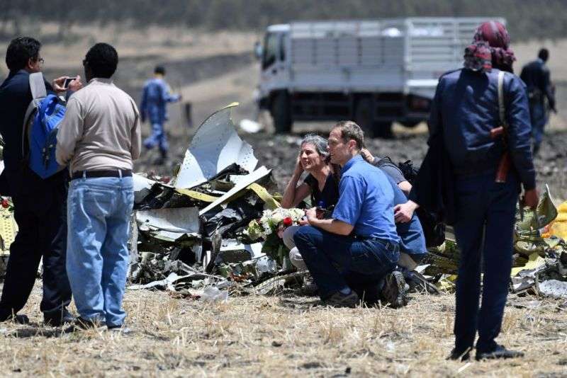
Both Ethiopian Airlines Flight 302 (ET302) and Lion Air Flight 610 (JT610) were recently acquired 737 MAX 8 aircraft, and both were lost with all aboard just minutes after take-off. According to the emergency order issued by the FAA, “new information from the wreckage concerning the aircraft’s configuration just after takeoff that, taken together with newly refined data from satellite-based tracking of the aircraft’s flight path, indicates some similarities between the ET302 JT610 accidents that warrant further investigation of the possibility of a shared cause for the two incidents that needs to be better understood and addressed.”
The source of the data in question is a combination of telemetry feeds from the flights’ Automatic Dependent Surveillance(ADS) system. Introduced in the US in 2001 and more widely worldwide in the wake of the crash of Malaysian Airlines flight 370 in 2014, Europe has required most aircraft to carry the UHF-band ADS-Broadcast (ADS-B) system since 2017, and the FAA has mandated ADS-B for most aircraft by 2020.
While ADS-B data was initially meant to be picked up by other aircraft and ground stations, it is also tracked by satellites. Other, less-granular telemetry data sent in the subscription-based ADS-addressed/Contract (ADS-A/ADS-C) format, the Future Air Navigation System(FANS), and the Aircraft Communications Addressing and Reporting System (ACARS) are also picked up by satellite.
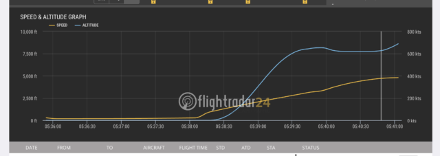
The investigation is not complete, and a direct link between the crashes is not certain. Witnesses to the ET302 crash said that they saw smoke coming from the aircraft before the crash. But the vertical speed profile of ET302 transmitted via the aircraft’s ADS-B telemetry showed a similar pattern of sudden dives to that of JT610. ADS-B data recorded for ET302 by FlightRadar24 shows that the aircraft, after reaching an altitude of 8,025 feet above sea level, suddenly dipped, plunging 400 feet before recovering briefly. But the aircraft’s vertical speed remained unstable, and a few minutes later it dove into the ground. For reference, the airport the flight took off from is at 7,631 feet above sea level—so the aircraft never reached more than 500 feet above the ground, not leaving much room for correction.
The damaged flight data recorder from ET302 has been sent to France for further analysis. The FAA and National Transportation Safety Board (NTSB) are supporting the investigation.


